
People are now panicking and also preparing for the coming of Super Typhoon Bopha(Bagyong Pablo). The expected landfall will be tomorrow, Tuesday, Dec. 4, 2012. Here are two reliable sources I`ve got this morning:
Typhoon ‘Pablo’ enters Philippine area of responsibility
ABS-CBNnews.com
Posted at 12/02/2012 6:54 PM | Updated as of 12/03/2012 8:31 AM
The weather bureau said typhoon Pablo entered PAR at 6:00 p.m. on Sunday. It was located 900 kilometers east of Hinatuan City
The typhoon is expected to affect Mindanao and Visayas, as well as areas in Southern Tagalog and Metro Manila, Pagasa earlier said.
"Pablo" is expected to make landfall over Surigao del Norte on Tuesday morning. Based on a 4:00 p.m. report, the typhoon was packing maximum sustained winds of 185 kilometers per hour (kph) and gustiness of up to 220 kph. It is also forecast to move west northwest at 22 kph.
PAGASA weather division chief Robert Sawi said floods and landslides are possible in Surigao, Davao, Compostela Valley, Misamis, Bukidnon, Lanao, Zamboanga, Leyte, Cebu, Bohol, Negros, Panay and Mindoro.
The typhoon will cross the Visayas islands on Wednesday towards Panay, northern Palawan and Mindoro, and over the South Philippine Sea on Thursday as it gradually weakens, the PAGASA weather division chief added.
PAGASA also said earlier there is a big possibility that it will become a super typhoon and may be even stronger than "Sendong," which caused massive destruction in Mindanao in December last year.
"Ang Sendong noong pumasok, 65 kph lang siya, pero ito 165 (kph) na ngayon," said PAGASA weather forecaster Jori Loiz.
Flights cancelled
Meanwhile, the Manila International Airport Authority reported that two Cebu Pacific flights were cancelled Sunday due to the weather condition.
Flights 5J 785 and 5J 786 were both bound for Butuan today.
Environment Secretary Ramon Paje, on the other hand, directed his field officials, including the regional directors of the Mines and Geosciences Bureau (MGB), to link up with local disaster management councils and issue geohazard advisories in areas that are expected to be affected by typhoon Pablo.
"As PAGASA has warned, we are expecting typhoon Pablo to dump large volume of rainfall inMindanao . We have to heed their warning and be prepared as this could bring adverse impact on the people such as landslides and flooding," Paje said.
The geohazard map shows the level or rating of an area's susceptibility (i.e. high, moderate or low) to landslide and flooding, from province to municipality down to the barangays.
He also asked the public to study the geohazard maps. "We have already distributed copies of the geohazard maps to all local government units, so they can take a look at it. Or, they may visit the regional offices of MGB or view them on the web," he said.
The maps can be accessed through the websites of the DENR, MGB, Philippine Information Agency and the Environmental Science for Social Change.
-------
'Pablo' slightly weakens; 2 areas under storm Signal 2
December 3, 2012 4:09am (Updated 7:08 a.m., 3 December 2012)
At least two areas were placed under Storm Signal No. 2 while 22 others were placed under Signal No. 1, even as Typhoon Pablo (Bopha) weakened slightly Monday morning, according to PAGASA.
Areas under Storm Signal No. 2 are:
- Surigao del Sur
- Northern part of Davao Oriental
- Siquijor
- Bohol
- Biliran
- Camotes Island
- Southern Leyte
- Leyte
- Eastern Samar
- Western Samar
- Surigao del Norte
- Siargao Island
- Dinagat Island
- Agusan del Norte
- Agusan del Sur
- Rest of Davao Oriental
- Davao del Norte including Samal Island
- Compostela Valley
- Bukidnon
- Misamis Occidental
- Misamis Oriental
- Camiguin
- Lanao del Norte
- Lanao del Sur
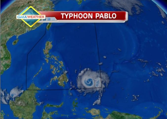
Satellite image at 7 am, Dec. 3
PAGASA warned residents in low-lying and mountainous areas under Storm Signals 2 and 1 against possible flash floods and landslides.
It also warned those living in coastal areas under storm signals to be alert against big waves or storm surges.
"Fishing boats and other small seacrafts are advised not to venture out into the Eastern Seaboards of Visayas and Mindanao," it added.
According to forecaster Mario Palafox, Typhoon Pablo is likely to make landfall north of Surigao del Sur before noon Tuesday.
"Inaasahan nating habang ito ay lumalapit sa kalupaan bahagyang hihina ang bagyong ito. At pag tumama sa lupa tuluyang hihina. Pero inaasahan natin malakas pa ang intensity pagtama ng lupa," Palafox said in an interview on dzBB radio.
He said that as of early Monday, the eastern part of Mindanao including Surigao del Sur and Davao Oriental are now starting to feel the effects of Typhoon Pablo.
While he said the effects include light rain for now, the rain will intensify and will be accompanied with strong winds as Typhoon Pablo moves closer to Mindanao.
Palafox said Typhoon Pablo will bring rain of 20 to 30 millimeters per hour (heavy to intense) from its 600-kilometer diameter.
"'Pag hindi nagbago ang takbo, Huwebes ng gabi o Biyernes ng umaga lalabas ito," he said.
As of 6 a.m., PAGASA estimated Typhoon Pablo at 645 kilometers southeast of Hinatuan, Surigao Del Sur, with maximum sustained winds of 175 kilometers per hour and gustiness of up to 210 kph.
It said Typhoon Pablo is moving west-northwest at 24 kph and may be 175 km east of Hinatuan, Surigao del Sur Tuesday morning.
By Wednesday morning it is expected to be 80 km south of Iloilo City. By Thursday morning it is expected to be 280 km northwest of Puerto Princesa City.
Weather outlook
PAGASA's 5 a.m. bulletin said Surigao Del Sur and the northern part of Davao Oriental will experience stormy weather with rough to very rough seas.
Northern Mindanao, the rest of Caraga Region, Davao Del Norte, the rest of Davao Oriental, Compostela Valley, Eastern Visayas, Bohol, Camotes Island and Siquijor will have rain with gusty winds with moderate to rough seas.
The regions of Cagayan Valley, Ilocos and CAR will have cloudy skies with light rains while Metro Manila and the rest of the country will be partly cloudy with brief rain showers or thunderstorms.
Moderate to strong winds blowing from the northeast to north will prevail over the rest of the country with moderate to rough seas.
Disaster monitoring systems activated
Interior and Local Government Secretary Mar Roxas on Sunday activated the department’s disaster monitoring systems in several regions where heavy rains are expected due to Pablo.
“In accordance with President PNoy’s (Benigno Aquino III) marching orders to ensure zero casualties from disasters, as much as possible, I have ordered our regional directors to make sure that the necessary precautions are undertaken to mitigate the effects of Tropical Storm Bopha,” Roxas said. “We have our existing protocols, and it is just a matter of implementing them and making other necessary preparations as appropriate.”
“In accordance with President PNoy’s (Benigno Aquino III) marching orders to ensure zero casualties from disasters, as much as possible, I have ordered our regional directors to make sure that the necessary precautions are undertaken to mitigate the effects of Tropical Storm Bopha,” Roxas said. “We have our existing protocols, and it is just a matter of implementing them and making other necessary preparations as appropriate.”
The order covers the Bicol Region, Central Visayas, Eastern Visayas, Northern Mindanao and Caraga where Pablo is expected to trigger heavy rains and along which there are also the threats of floods, landslides and mudslides.
Local government heads, the PNP, Philippine Coast Guard, and barangay officials in the affected areas were also advised to step up their information dissemination efforts to warn fisherfolks not to sail due to the typhoon.
Likewise, small scale miners and residents along river systems, landslide-prone areas (Eastern seaboard) were asked to be on alert for the effects of Pablo.
Roxas also said that the Philippine National Police has been alerted and its disaster response units are on standby and ready to mount rescue missions on short notice in areas that are in the path of Pablo. — Gian C. Geronimo/DVM, GMA News
--------
To all my fellowmen who are now in the Philippines, please let`s prepare ourselves for this another trial in our lives. Keep safe and pray always. Stay in tune for the latest news.
To all our Kababayan, friends and relatives in other countries, please pray for us, Filipinos, here in the Philippines.
Prayers is one of the best thing that we can do now. Hoping that this super typhoon will lead to the other way or the force of it will not as strong as what the latest breaking news on internet said.
ReplyDeletehi apple! Thanks to all who prayed for us. Most of us are safe now. My condolences to those who lost their loved ones.
Delete